
THE GULF STREAM
The Gulf Steam defined
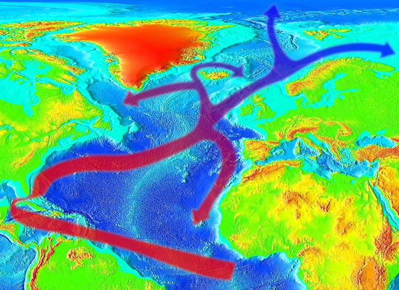
The Gulf Stream, together with its northern extension towards Europe, the North Atlantic Drift, is a powerful, warm, and swift Atlantic ocean current that originates at the tip of Florida and follows the eastern coastlines of the United States and Newfoundland before crossing the Atlantic Ocean. The process of western intensification causes the Gulf Stream to be a northward accelerating current off the east coast of North America. At about 40º0´N 30º0´W, it splits in two, with the northern steam crossing to northern Europe and the southern steam recalculating off West Africa. The Gulf Steam influences the climate of the east coast of North America from Florida to Newfoundland, and the west coast of Europe. Although there has been recent debate, there is consensus that the climate of Western Europe and Northern Europe is warmer than it would otherwise be due to the North Atlantic drift, one of the branches from the tail of the Gulf Steam. It is part of the North Atlantic Subtropical Gyre (Gyre: A giant circular oceanic surface current). Its presence has led to the development of strong cyclones of all types, both within the atmosphere and within the ocean. The Gulf Stream is also a significant potential source of renewable power generation. 
The discovery of the Gulf Steam
Juan Ponce de León, an european explorer discovered the Gulf Steam which dates back to his 1513 expedition, after which it became widely used by Spanish ships sailing from the Caribbean to Spain. A summary of Ponce de León’s voyage log, on April 22, 1513, noted, "A current such that, although they had great wind, they could not proceed forward, but backward and it seems that they were proceeding well; at the end it was known that the current was more powerful than the wind.” Peter Martyr d’Anghiera an Italian born historian of Spain, and Sir Humphrey Gilbert an explorer, member of parliament and soldier who served the crown during the reign of Queen Elizabeth 1 of England also knew of the Gulf Steam existence.
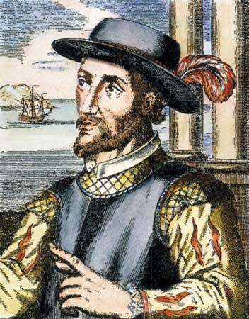


Juan Ponce de León Peter Martyr d’Anghiera Sir Humphrey Gilbert
Another well known noble person who worked as deputy postmaster of the British American colonies, who took an interest in the North Atlantic Ocean circulation patterns was Benjamin Franklin.
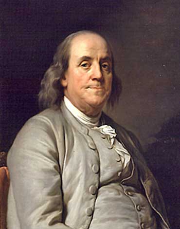
Benjamin Franklin
Here is the story:
In 1768, while in England, Franklin heard a curious complaint from the Colonial Board of Customs; why did it take British packets several weeks longer to reach New York from England than it took an average American merchant ship to reach Newport, Rhode Island, despite the merchants ships leaving from London and having to sail down Thames and then the length of the English Channel before they sailed across Atlantic, while the packets left from Falmouth in Cornwall?Franklin asked his cousin Timothy Folger, a Nantucket whaling captain, for an answer and Folger explained that merchant ships routinely crossed the then-unnamed Gulf Stream – indentifying it by whale behaviour, measurement of the water’s temperature and the speed of bubbles on its surface, and changes in the water’s color – while the mail packet captains ran against it. Franklin worked with Folger and other experienced ship captains, learning enough to chart the Gulf Stream and giving it the name by which it is still known today. He offered this information to the Anthony Todd, secretary of the British Post Office, but it was ignored by British sea captains.
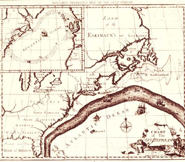
Benjamin Franklin’s Map of the Gulf Stream
Franklin’s Gulf Stream chart was published in 1770 in England, where it was mostly ignored. Subsequent versions were printed in France in 1778 and the U.S.A in 1786. It took many years for the British to follow Franklin’s advice on navigating the current but once they did, they were able to gain two weeks in sailing time.
Formation and behaviour
A river of sea water, called the Atlantic North Equatorial
Current, flows westward off the coast of northern Africa. When this current interacts with the
northeastern coast of South America, the
current forks into two branches. One
passes into the Caribbean Sea, while a second, the Antilles Current, flows
north and east of the West Indies. These two branches rejoin north of the Straits of Florida, as shown on the accompanying
map.
Gulfstream
The trade winds blow westward in the tropics, and the westerlies blow eastward at mid-latitudes. This wind pattern applies a stress to the subtropical ocean surface with negative curl across the North Atlantic Ocean. The resulting Sverdrup transport is equatorward. Because of conservation of potential vorticity caused by the northward-moving winds on the subtropical ridge’s western periphery and the increased relative vorticity of northward moving water, transport is balanced by a narrow, accelerating poleward current, which flows along the western boundary of the ocean basin, outweighing the effects of friction with the western boundary current known as the Labrador current. The conservation of potential vorticity also causes bends along the Gulf Stream, which occasionally break off due to a shift in the Gulf Stream’s position, forming separate warm and cold eddies. This overall process, known as western intensification, causes currents on the western boundary of an ocean basin, such as the Gulf Steam, to be stronger than those on the eastern boundary.
Note: For more technical information regarding
eddies, please follow the link below
http://www.classzone.com/books/earth_science/terc/content/investigations/es2403/es2403page06.cfm
Typically, the Gulf Stream is 100 kilometres (62 mi) wide and 800 metres (2,600 ft) to 1,200 metres (3,900 ft) deep. The current velocity is fastest near the surface, with the maximum speed typically about 2.5 metres per second (5.6 mph). As it travels north, the warm water transported by the Gulf Stream undergoes evaporative cooling. The cooling is wind driven: wind moving over the water cools it and also causes evaporation, leaving a saltier brine. In this process the water increases in salinity and density, and decreases in temperature. Once sea ice forms, salts are left out of the ice, a process known as brine exclusion. These two processes produce water that is denser and colder (or, more precisely, water that is still liquid at a lower temperature). In the North Atlantic Ocean, the water becomes so dense that it begins to sink down through less salty and less dense water. (The convective action is not unlike that of a lava lamp.) This downdraft of heavy, cold and dense water becomes a part of the North Atlantic Deep Water, a southgoing stream. Very little seaweed lies within the current, although seaweed lies in clusters to its east.
Localized effects
The Gulf Stream is influential on the climate of the Florida peninsula. The portion off the Florida coast, referred to as the Florida current, maintains an average water temperature at or above 25 ºC (77 ºF) during the winter. The North Atlantic current of the Gulf Stream, along with similar warm air currents, helps keep Ireland and the western coast of Great Britain a couple of degrees warmer than the east. However, the differences is most dramatic in the western coastal islands of Scotland. A noticeable effect of the Gulf Stream and the strong westerly winds (driven by the warm water of the Gulf Stream) on Europe occurs along the Norwegian coast. Northern parts of Norway lie close to the Arctic zone, most of which is covered with ice and snow in winter. However, almost all of Norway’s coast remains free of ice and snow throughout the year. Weather systems warmed by the Gulf Stream drift into Northern Europe, also warming the climate behind the Scandinavian mountains.
Tropical cyclone formation
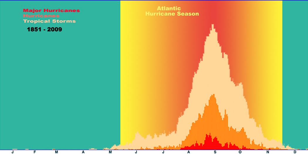
Tropical cyclone generation normally requires water temperatures in excess of 26.5 ºC (79.7 ºF). Tropical cyclone formation is common over the Gulf Stream. The Atlantic basin shows a very peaked season from August through October, with 78% of the tropical storm days, 87% of the minor (Saffir-Simpson Scale categories 1 and 2) hurricane days, and 96% of the major (Saffir-Simpson categories 3, 4 and 5) hurricane days occurring then. Maximum activity is in early to mid September.
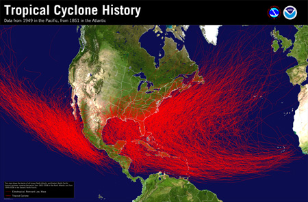
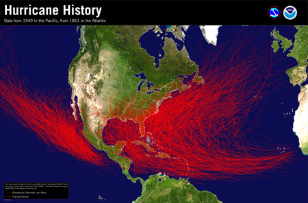
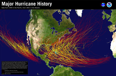
Tropical Hurricane Major Hurricane
Storms travel westward through the Caribbean and then, either move in a northward direction and curve towards the eastern coast of the United States, or stay on a north-westward track and enter the Gulf of Mexico. Such storms have the potential to create strong winds and extensive damage to the United States, Southeast Coastal Areas and also in Northeastern Canada. One example of this was on September 29, 2003: Hurricane Juan is sometimes considered Atlantic Canada's most widely destructive hurricane in over a century. Juan killed 8 and caused over $200 million in damage. Power outages in Nova Scotia and Prince Edward Island left over 300,000 Canadians without power for two weeks. Many marinas were destroyed and many small fish craft were damaged or sank. Hurricane force gusts were reported as far out as 100 miles (160 km) on either side of Juan at landfall with an astounding peak gust of 144 mph (229 km/h) (equivalent to a category 4 hurricane) recorded in Halifax Harbour, although it was a Category 2 at landfall with 100 mph (160 km/h) sustained winds. A more recent was on September 20-21, 2010: Hurricane Igor, was unusual in that it restrengthened somewhat during its final approach despite being over cool water. Maximum sustained winds were estimated to be at least 120 km/h (80 mph), but gusts up to 170 km/h (105 mph) were reported. Strong extratropical cyclones have been shown to deepen significantly along a shallow frontal zone, forced by the Gulf Stream itself during the cold season. Subtropical cyclones also tend to generate near the Gulf Stream. 75 percent of such systems documented between 1951 and 2000 formed near this warm water current, with two annual peaks of activity occurring during the months of May and October. Cyclones within the ocean form under the Gulf Stream, extending as deep as 3,500 metres (11,500 ft) beneath the ocean’s surface.
An interesting fact
The Gulf Stream transports about 1.4 petawatts of heat, equivalent to 100 times the world energy demand.